Walking and cycling improvements
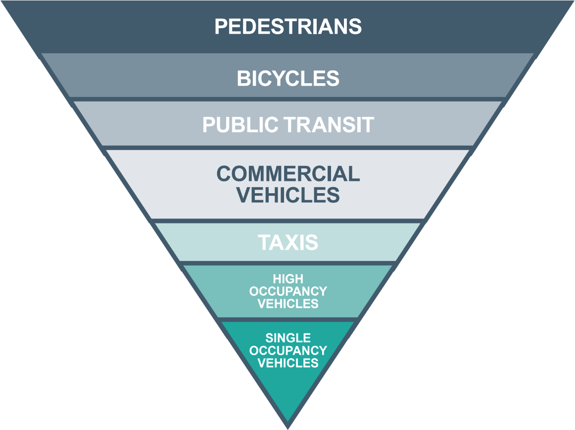
To prioritise and encourage more active travel (walking and cycling), the harbour fronts need improvements to walking and cycling infrastructure, such as crossings, cycle parking and cycle lanes. The width of many pavements is very narrow and often compete with parking spaces or are pushed up against the harbour wall or edge.
Feeling safe walking and cycling around is an important priority for all, whether you are walking for leisure, to the shops, or even from your car in one of the car parks.
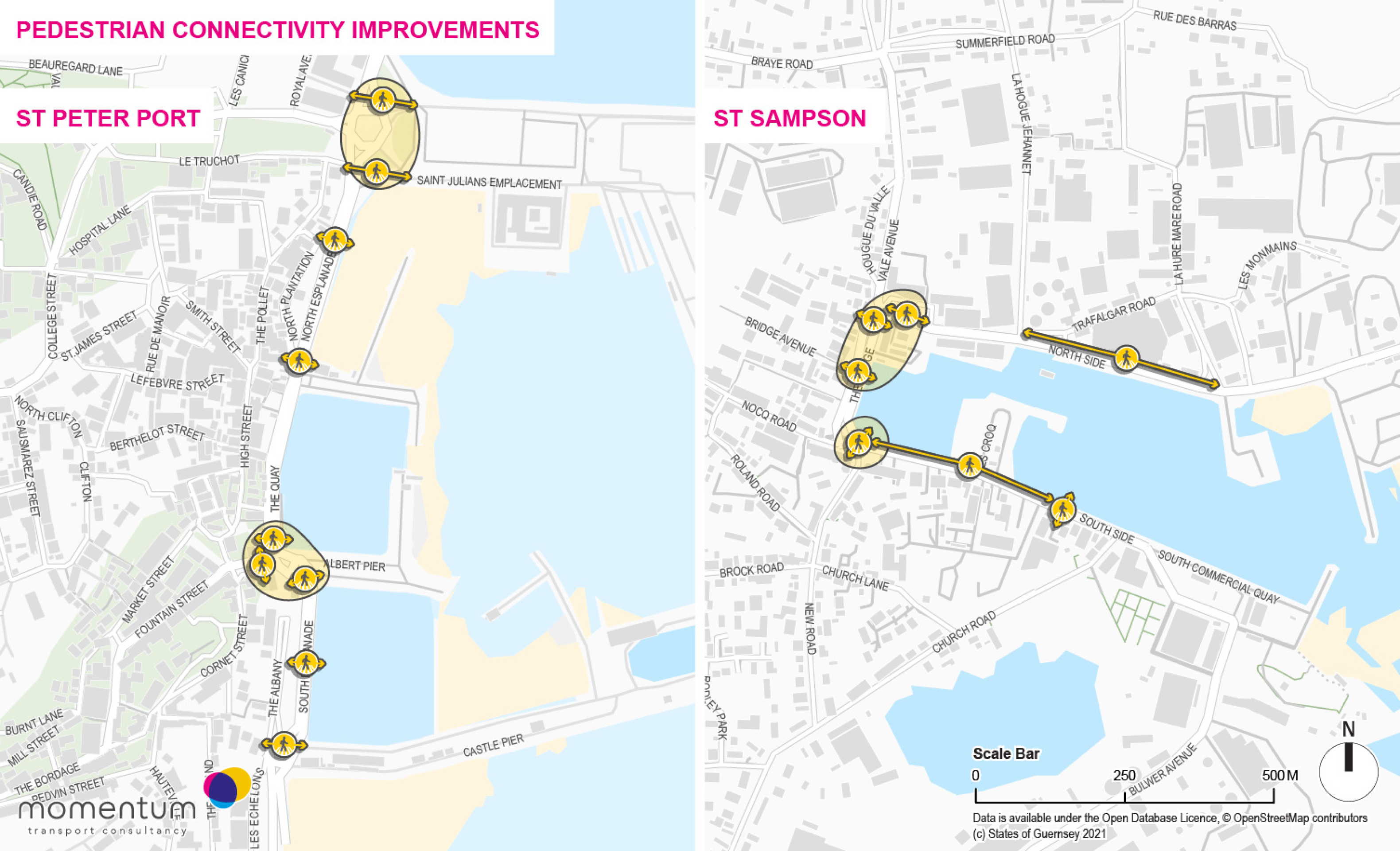
The maps show areas of poor pedestrian connectivity and where new or improved crossings and footways may be needed in both Harbour Action Areas to support all users.
Potential for Pedestrian Connectivity Improvements - click to enlarge
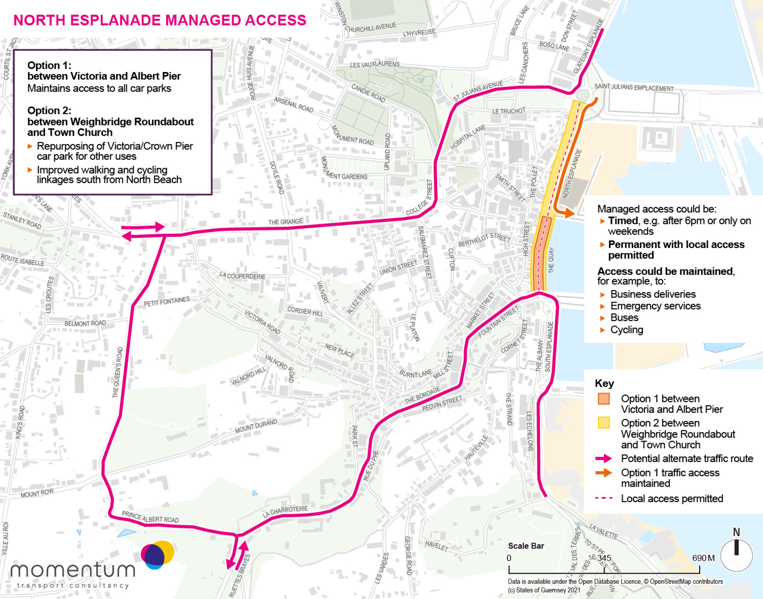
Expanding “Seafront Sundays” at North Esplanade - click to enlarge
The Local Planning Brief will:
- Support measures that improve provision for pedestrians and cyclists including wider pavements, more cycle parking and cycle routes
- Set out ideas for extending “seafront Sundays as a permanent solution along parts of the Esplanades
- Set out ideas for removing through traffic and industrial vehicles from The Bridge to a different location across the harbour
Bus Service Improvements
Guernsey is well served by bus routes and prices are low compared to other places. Measures to support buses could reduce traffic congestion by moving people from cars to buses which fit more people and don’t have to find somewhere to park at their arrival point. To encourage more people to travel by bus than by car, it would be beneficial to:
- Support increasing bus frequencies on key routes
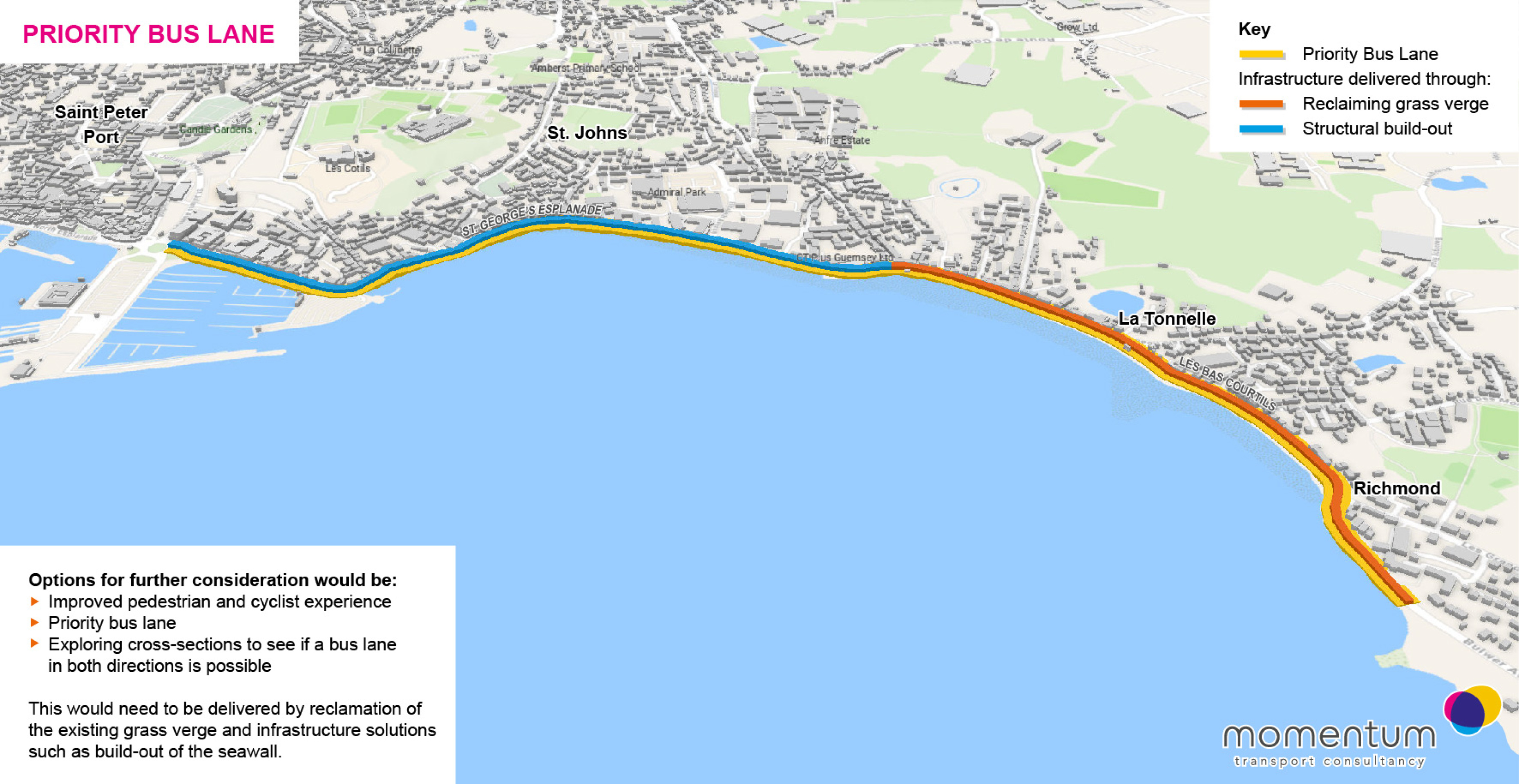
- Create a priority bus lane between St Peter Port and St Sampson by extending outwards.
Priority bus lane plan - click to enlarge
The Local Planning Brief will:
- Support the provision of a dedicated bus link between the two harbour action areas that makes it easier for those that want to to choose sustainable travel options and reduce parking demand in St Peter Port
Supporting E-Bikes
E-bikes are popular on Guernsey and have become an increasingly well used transport option for many people. They cope well with the hills and can be used by people of a wide ranges of ages abilities. Existing cycle parking areas are well used and popular and would benefit from further expansion.
Docking spaces for any future shared or rental e-bike service (like the previous EVie scheme) would further support cycling and the use of mobility hubs and may help ease traffic congestion.
Mobility Hubs
A mobility hub is a place where a range of active and sustainable travel facilities are grouped together for convenience and to make moving around between travel modes easier. Mobility hubs could be located at The Bridge and at North Beach and/or South Esplanade. This would help to encourage cycling and public transport use within and between the two harbours.
Each mobility hub could incorporate:
- Bus stop with sheltered seating and real-time service updates
- Covered cycle parking and repair facilities
- Shared e-bike rental service/e-bike parking and charging
- Maps of local walking and cycling routes
- Car club vehicles
- Parcel lockers
The Local Planning Brief will:
- Support the creation of mobility hubs that make active and sustainable travel easier and provide a focussed location for interchange and related facilities
- Consider and propose locations for mobility hubs to be created and ensure they are well located and convenient to access and use
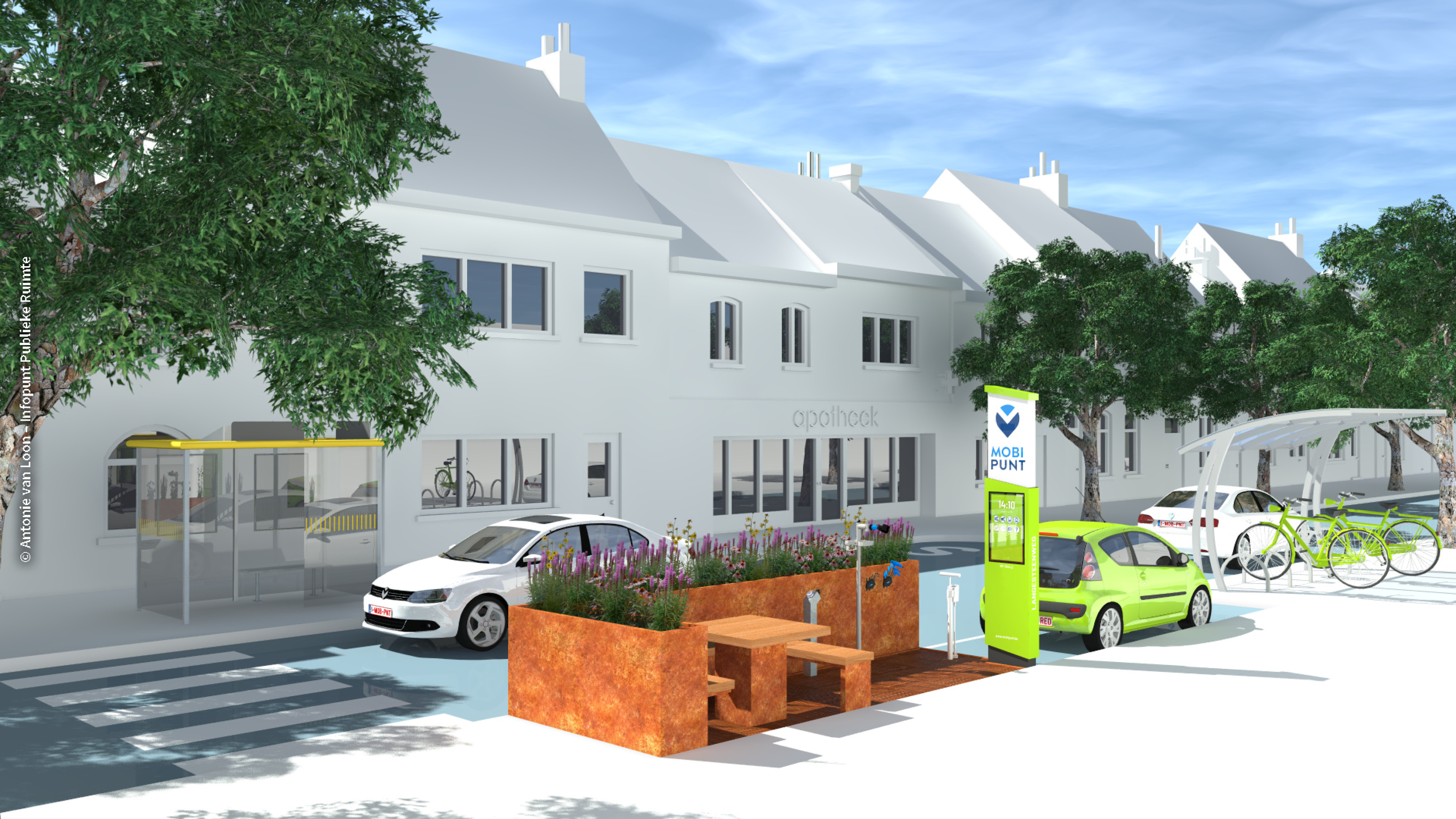
Image credit: SHARE North
Introducing Car Parking Management and Charges
As the On-Island Integrated Transport Strategy states “No amount of improvement to other forms of transport will be sufficiently effective in modal shift from the car when it is competing with the ability to park all day for nothing.”
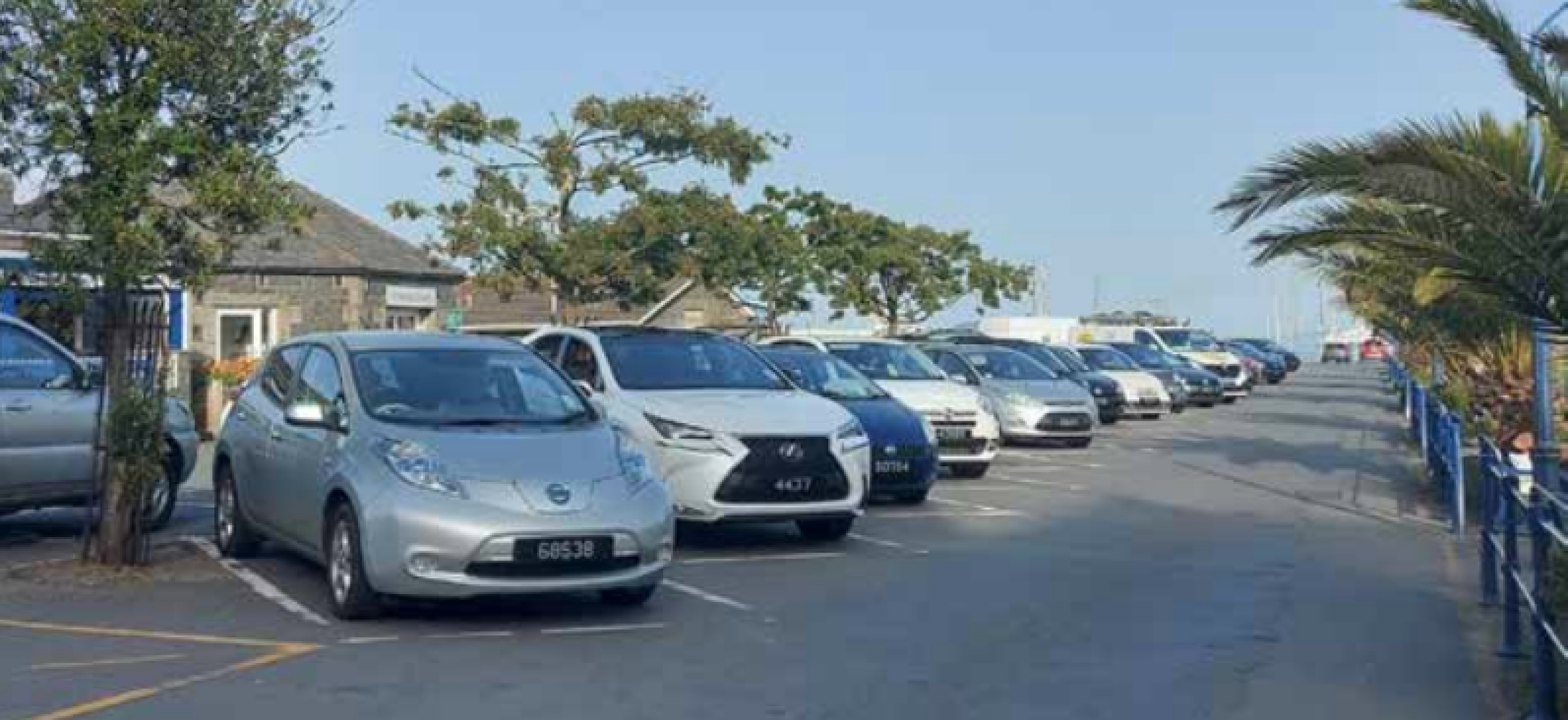
Car parking is one of the main land uses in the St Peter Port Harbour Action Area and opportunities for change and investment will be limited unless this use can be reduced, relocated or managed differently. In order to make better use of the Harbour Action Areas and enable investment a range of measures may need to be considered, such as car parking management methods e.g. paid long stay parking for commuters, demand-based pricing so those who park further away from town pay the lowest charges. This would help to reduce congestion and demand on the harbour front by encouraging a modest percentage of drivers to use other means or car share. Only a small proportionate reduction e.g. 10%-20% could make a big difference to the potential of the harbours to deliver new uses and to work better for all.
A reduction in demand on car parking, together with ideas such as decked car parks, could create opportunities for new development and bring activity, jobs and other opportunities to the harbours which would help support the local economy.
The Local Planning Brief will:
- Support measures that allow some of the space given over to car parking in St Peter Port Harbour to be reduced or relocated in order to create opportunities for change and to support the local economy
- Support measures that encourage those that want to consider alternative means to get to the harbour for work
