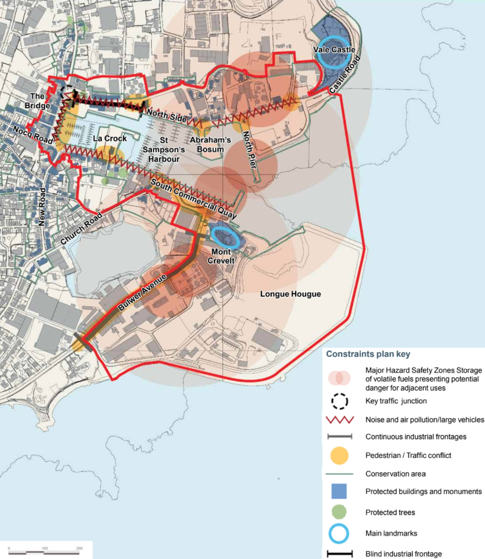
St Sampson Harbour Action Area Summary Constraints Plan
St Sampson Harbour Action Area Summary Constraints Plan - click to enlarge
Land uses, including housing, commercial and industrial and town centre uses
St Sampson is the second town on the island and includes a good range of local shops and services. The Bridge is a popular location for local shopping.
There is an under supply of new housing to meet the island’s housing need but no easy way to provide new homes in the St Sampson Harbour Action Area without addressing future flood risk issues and relocating or upgrading some of the “bad neighbour” industrial activities, such as fuel storage and the power station.
Employment land on the island generally is being squeezed due to pressures on the harbours and residential demand – there is a need to protect employment expansion land and to carefully consider the best location for this. Longue Hougue is already an important focus for industrial activity.
Marine industrial uses, including boat repairs and storage around the harbour, help support the water based activity and support jobs and services around St Sampson. Many of these uses are located along North Side/Castle Road.
Space for people
St Sampson and the Harbour Action Area has a very urban character with little green space, landscaping or planting. The routes directly around the harbour feel like a positive place to be despite the conflict with vehicles but there are few opportunities to sit and enjoy the proximity to water and views out. Pedestrian routes to the harbour are very poor in some locations. The GDA survey identified places for eating and drinking as something that is missing in St Sampson.
Marina uses and cargo
The vibrant marine leisure sector offers potential for growth and adding value to the island. A key focus of these uses is in St Sampson around the well used harbour.
Some marine leisure supply chain activities might be relocated to Longue Hougue, thereby creating opportunities for alternative uses within the St Sampson HAA. The impact of growing flood risk on all marine activities presents an opportunity to combine new facilities with flood defences.
Fuel storage and energy security
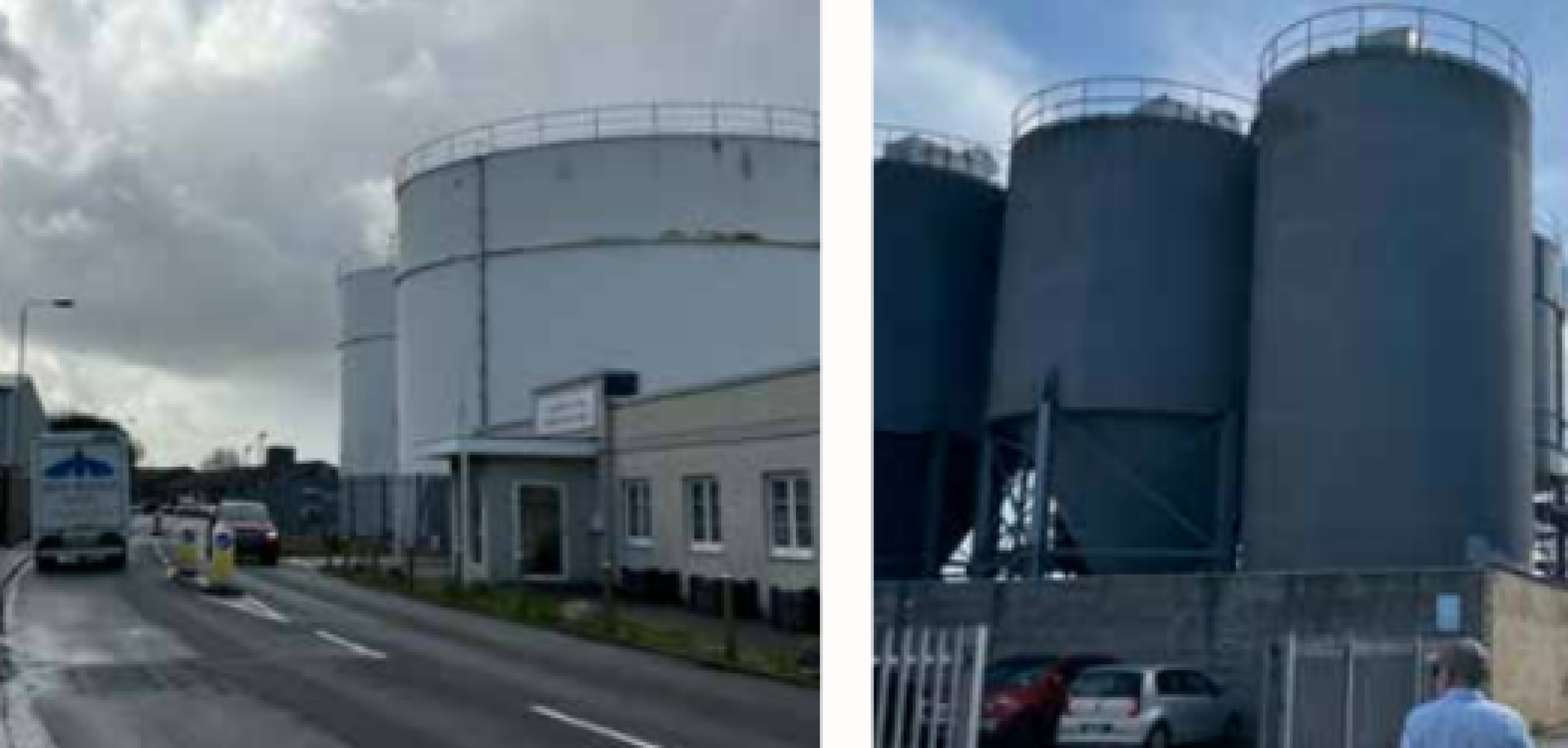
Fuel storage and the associated Major Safety Hazard Zones (as shown on the constraints plan) prevent intensive such as housing or offices from taking place within these areas. Alternative methods for generating and importing energy in the future may mean there is less demand for liquid fuel (and therefore its storage) which could enable a reduction in storage space and create potential for its relocation.
In the future de-carbonisation of the grid could also reduce demand as more energy is made in renewable ways on the island. This could change requirements for energy generation and the power station, which could become redundant over time.
Heritage and character
St Sampson has a strong character that comes from the consistent built frontage enclosing and overlooking the harbour and water based activity.The mix of town centre and industrial uses is part of this character although some of the buildings and uses e.g. the power station are more negative than positive at the moment. The strong use of granite in buildings and historic walls and features help make the harbour area distinctive. There are heritage landmarks at Mont Crevelt and Vale Castle either side of the entrance to the harbour.
Wider links
Making sure people can get to St Sampson easily and between St Sampson and St Peter Port is important for making sure it works well as the second town.
There are a lot of walkers and cyclists who walk around the coast and are looking for better and safer connections e.g. north to Bordeaux Harbour.
St Sampson has bus services that connect to a number of locations on the island but there is little space at The Bridge for bus stops and no coordinated interchange for transport modes or information.
Traffic, congestion and pollution
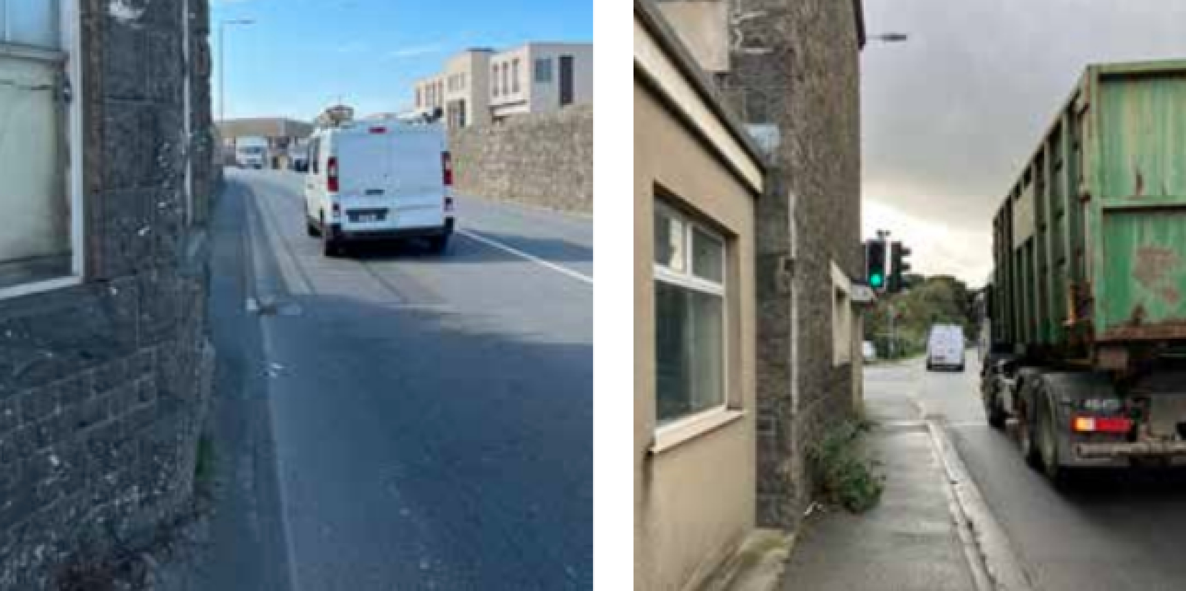
South Quay, North Quay and The Bridge all suffer high levels of congestion and traffic at various times of the day. This leads to issues with air pollution and noise pollution, and a poor pedestrian environment.
Car parking data from 2021 indicates a high average utilisation (81% and above) of 23-hour and 10-hour car parking at the Bridge. The provision of free parking keeps this demand high but doesn’t encourage more sustainable or active travel such as the use of e-bikes which are gaining popularity on the island.
There may be potential for routing through traffic and larger vehicles across the harbour instead of around it. This may make The Bridge frontage less busy with cars and larger vehicles and a nicer place to be for pedestrians.
Flood risk
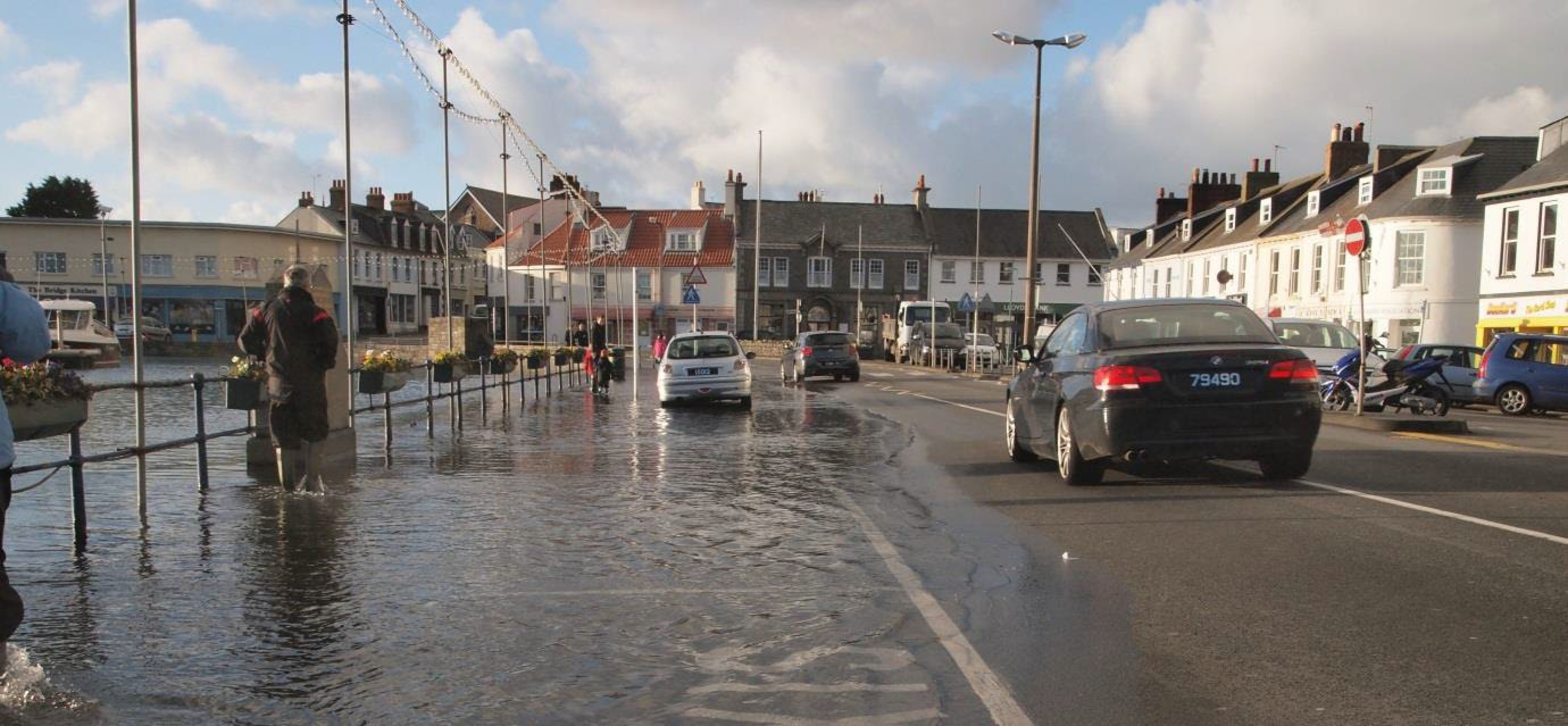
St Sampson is subject to coastal flooding, with the Bridge currently flooding during some high tide events. This is predicted to get worse with climate change as sea level rises and storms become more intense. Low-lying areas to the West of the Bridge are particularly vulnerable to flooding. The harbour is well protected from wave action by the existing harbour piers and breakwaters.
In the future climate adaptation and flood risk mitigation measures will need to accompany development proposals as part of longer term infrastructure upgrade. The regeneration of the harbour offers an opportunity to respond holistically to climate change, and to help the island achieve Net Zero Carbon by 2050, as well as protecting and enhancing biodiversity.
Tourism and leisure
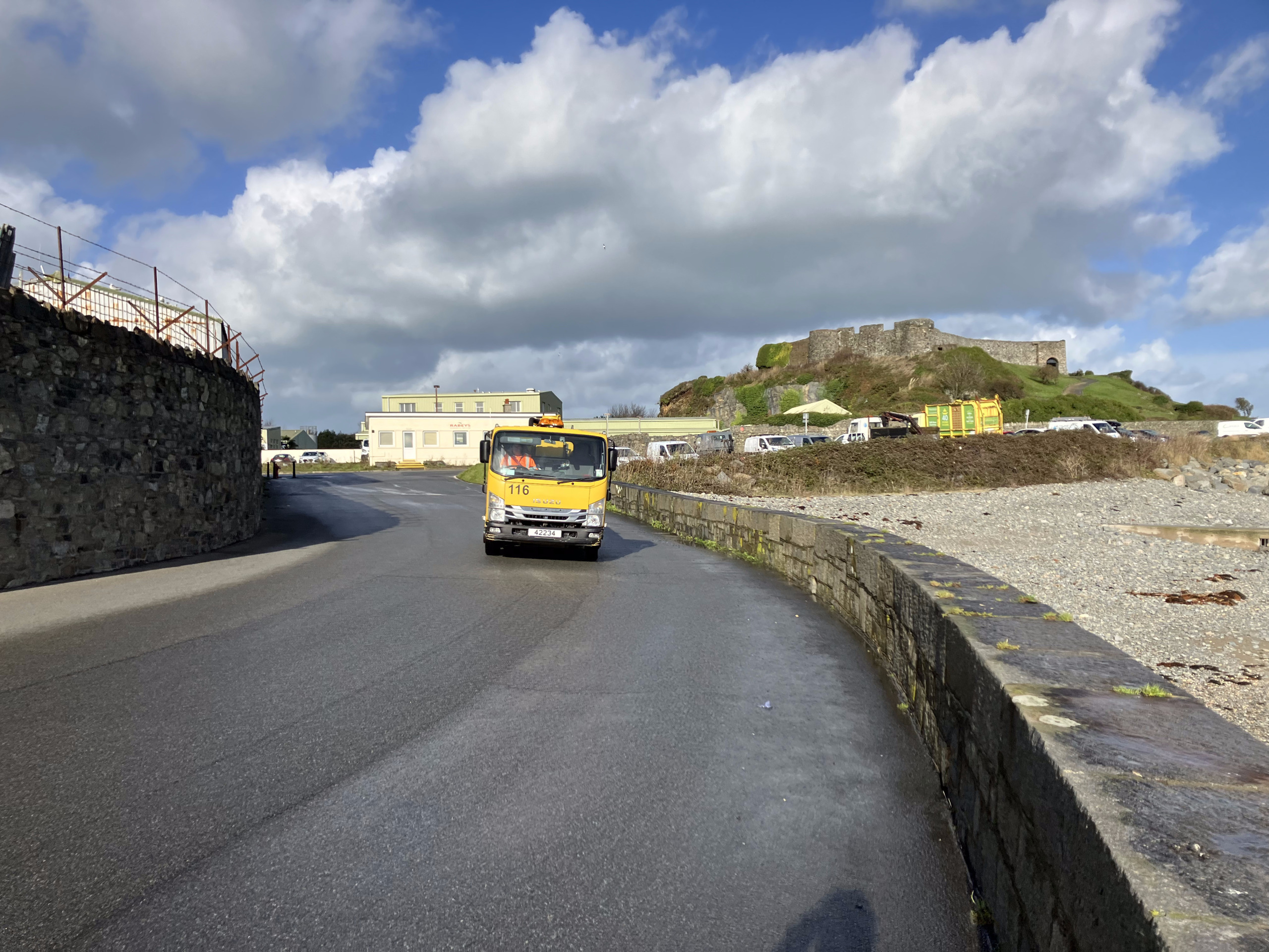
There is currently a limited tourism offering in St Sampson. Opportunities to make it a more popular place to spend time, enjoy the waterfront and heritage features, such as Vale Castle (right), may change this in the future. A lack of restaurants and bars was identified in the GDA survey.
The main leisure focus of the harbour area is boating related and the area has a lot of small and medium sized boats. There are a number of sites and buildings that could be well used for restaurants and cafes and place to enjoy being next to the water year round.
